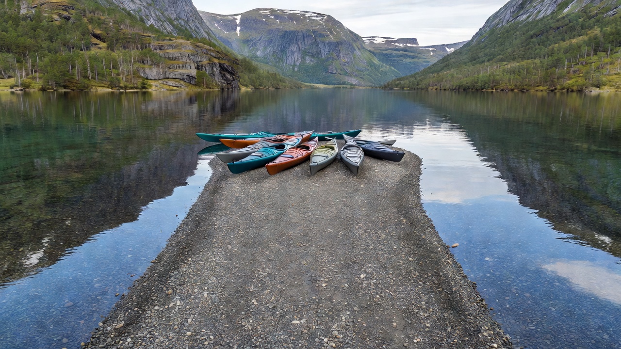
Match a Shore to Your Plans

Postcards of Norway inevitably highlight the steepest cliffs and deepest troughs—places like Trollfjorden in Vesterålen, Geirangerfjorden in Møre og Romsdal, or the emerald ribbon of Lake Gjende in Jotunheimen. Yet for a recreational skipper or kayak tourer, picking a destination by visual drama alone often leads to long hours peering up at unlandable vertical rock while dodging tourist ferry wakes.

A better way to choose a waterway is to start with your hull, your propulsion, and how often your crew wants to step ashore. Norway’s waters divide into four distinct environments: broad lowland agricultural lakes, sub-arctic highland basins, lock-connected valley canals, and glacially carved marine fjords. Each rewards a different rhythm of travel.

01 — Inland & Mountain Lakes: Fresh Water, Steep Basins, and Regulated Shores

Norway counts hundreds of thousands of lakes, ranging from Mjøsa—covering 369 square kilometres across Innlandet and Akershus—to high-altitude basins perched near the tree line at 900 to 1,100 metres above sea level. Because these waters are landlocked, you never have to calculate tidal streams or deal with salt encrustation on engine cooling lines. However, inland lakes present three specific planning variables that catch coastal boaters by surprise.

First is wind fetch and wave steepness. On Lake Femunden (662 m ASL, 60 km long), a moderate southerly wind has dozens of kilometres of unobstructed fetch to build steep, closely spaced waves. Because fresh water is less dense than ocean water, hulls sit slightly lower and small open boats take spray over the gunwales sooner than they would in a sheltered coastal sound. Second is hydro-electric water level regulation. Lakes such as Møsvatn at the edge of Hardangervidda or Bygdin in Valdres experience seasonal drawdowns that expose muddy boulders, old tree roots, and shortened slipways in early summer or late autumn. Third is motor regulation: many highland waters sit inside national parks or municipal conservation zones where only oars, paddles, or small electric trolling motors are permitted.

Mjøsa (Innlandet)

Best for: Day cruisers, trailerable runabouts, sailing dinghies, and multi-day harbour hopping.

Norway’s largest lake features well-marked navigation buoys, active marinas at Hamar, Gjøvik, Brumunddal, and Moelv, and sheltered lee shores behind Helgøya island. Watch out for the historic paddle steamer DS Skibladner, which maintains right of way on its scheduled summer routes.

View Mjøsa harbour access

Femunden (Innlandet / Trøndelag)

Best for: Canoes, expedition kayaks, and seaworthy open fishing boats.

Bordering Femundsmarka National Park, this shallow, boulder-lined highland lake offers pine-forested gravel coves and historic timber halts served by the passenger vessel MS Fæmund II. Weather shifts rapidly from the Swedish border mountains.

Check highland wind patterns

Bandak & Nisser (Telemark)

Best for: Family cruisers, wooden heritage boats, and sheltered touring.

Bandak forms the dramatic western terminus of the Telemark Canal up to Dalen, while nearby Nisser offers rare freshwater sand beaches and warm mid-summer shallows ideal for family rest stops.

See Telemark slipways

02 — Western & Northern Fjords: Deep Sill Basins and Tidal Corridors

Cruising or paddling a Norwegian fjord places you inside a drowned glacial valley where depths regularly plunge past 400 to 1,300 metres just a stone’s throw from shore. That underwater geometry explains both the calm majesty and the operational challenges of fjord boating.

Because the seabed drops almost vertically, anchoring in open water is rarely possible. You must plan every lunch stop or overnight halt around a floating guest pontoon, an old steamer quay, a gravel river delta (elvedelta), or a natural rock cleft where you can tie bow to stern lines ashore. Furthermore, inner fjord branches such as Nærøyfjorden, Lustrafjorden, and Hjørundfjorden receive enormous volumes of cold snowmelt from May through July. This creates a fast-moving surface layer of brackish water that flows outward toward the coast regardless of the rising tide beneath it. When an afternoon sea breeze blows inward against that outgoing surface current, short, steep standing chop forms quickly at narrow headlands.

MOUNTAIN LAKE BASIN Shallow moraine shelf FJORD SILL & DEEP BASIN 400m–1200m abyss (No anchoring)

Selecting the Right Fjord Arm

If you operate a kayak, rowboat, or 16-foot outboard skiff, skip the main trunk of Sognefjorden or Hardangerfjorden during afternoon winds and launch instead inside side branches like Esefjorden near Balestrand, Fyksesund in Hardanger, or Hjørundfjorden in Sunnmøre, where high ridges break the outer ocean swell.

Review required fjord safety gear

03 — Waterway Selection Matrix

Use this reference table to narrow down representative Norwegian waterways by craft suitability, motor permissions, and typical landing terrain.

Waterway & Region Water Type & Elevation Ideal Small Craft Motor Rules & Traffic Typical Landing Points
Mjøsa (Innlandet) Freshwater lake, 123 m ASL Cabin cruisers, trailered boats, sailboats Open navigation; 5-knot harbour zones; DS Skibladner route Full-service guest marinas, concrete slipways, Helgøya piers
Gjende (Jotunheimen) Glacial lake, 983 m ASL Experienced sea kayaks, licensed local boats Strict national park motor ban for visiting recreational boats Gravel fans at Memurubu & Gjendebu (keep clear of MS Gjende quay)
Tinnsjå (Telemark) Deep valley lake, 190 m ASL Kayaks, day cruisers, fishing boats Open to motors; quiet heritage traffic near Mæl Sand bays at Sandviken, gravel pull-outs, municipal ramps
Nærøyfjorden (Vestland) UNESCO fjord branch, 0 m ASL Sea kayaks, well-equipped small boats Zero-emission / speed zone rules; frequent tour vessels Gravel beaches at Bakka & Dyrdal, floating quays at Gudvangen
Lysefjorden (Rogaland) Steep granite fjord, 0 m ASL Cabin ribs, seaworthy cruisers, guided kayaks High-speed commuter ferries; strong thermal winds Floating pontoons at Forsand, Flørli, and Lysebotn
Continue to Lake Harbours & Slipways